Page 1 of 3
Maps of Cambodia
Posted: Wed Sep 21, 2016 8:19 pm
by CEOCambodiaNews
Recent maps of Cambodia are not always easy to find, and most of the guidebooks are out of date. Google Earth included. Roads and bridges are being constructed all the time. If you have any recent maps, please post them here. These are maps of Cambodia already posted on the forum or elsewhere, so any updates are welcome:
Cambodia:
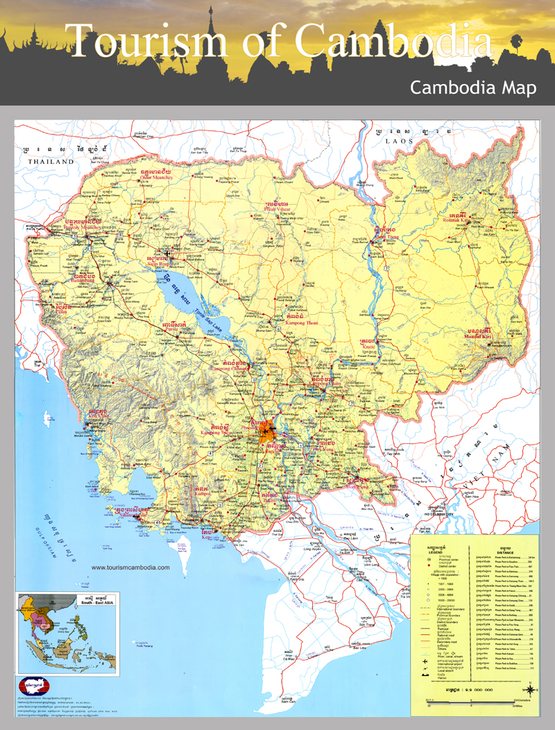
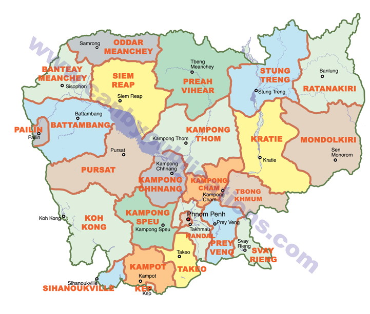
Where are the provinces located ?
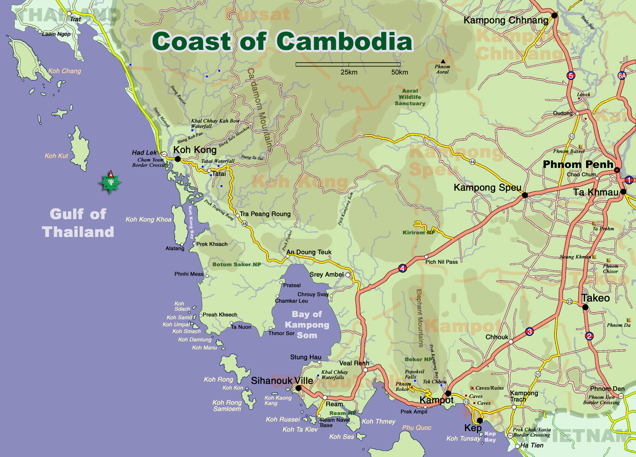
Coast of Cambodia:
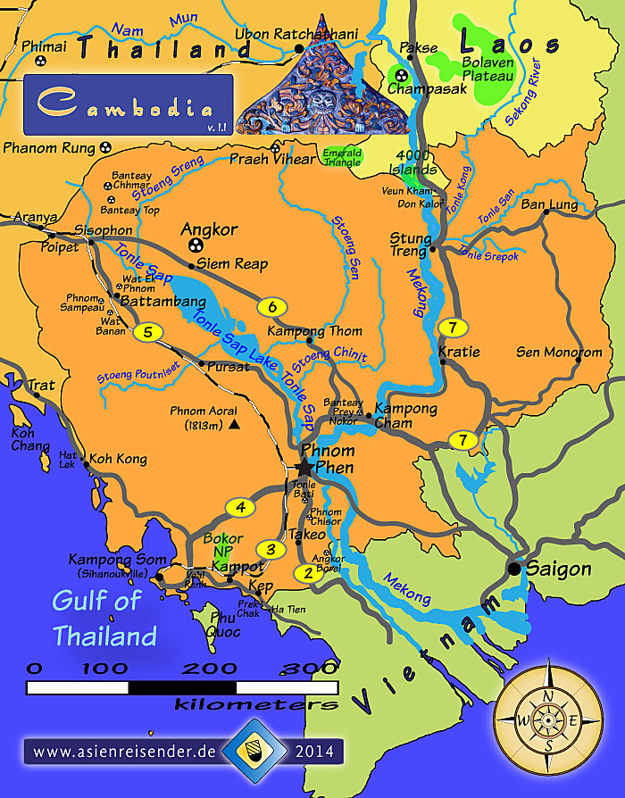
Road network in North-east Cambodia:
 https://www.facebook.com/Travel-Northea ... 864356775/
Re: Maps of Cambodia
Posted: Wed Sep 21, 2016 9:47 pm
by Username Taken
The provinces map has a huge watermark across it. I hope you got permission from the copyright owner to use that map.
Re: Maps of Cambodia
Posted: Sat Nov 26, 2016 7:29 pm
by CEOCambodiaNews
Map of Kep.

Map of Kampot river area.

Thank you and credit to the Kampot Survival Guide facebook page:
Be sure to check out the KSG if you go to Kampot. Full of all sorts of (mis)information.
Re: Maps of Cambodia
Posted: Sat Nov 26, 2016 7:54 pm
by phuketrichard
i use open maps on my garmn gps, invaluable on roads not on any printed map
also check out maps me,
http://maps.me/en/home for ur smart phone, on google play
https://play.google.com/store/apps/deta ... e.maps.pro
we used it recently in Burma, 10x better than google maps
Re: Maps of Cambodia
Posted: Tue Nov 29, 2016 9:25 am
by Sunnyside up
Agreed. Maps.me is excellent for offline orientation.
Re: Maps of Cambodia
Posted: Tue Nov 29, 2016 10:32 am
by beaker
Sunnyside up wrote:
Agreed. Maps.me is excellent for offline orientation.
Sygic is better and free on many torrent sites
Re: Maps of Cambodia
Posted: Tue Jan 17, 2017 8:19 pm
by CEOCambodiaNews
Map with the past - and possible future - railway line from Sihanoukville to the Thai border at Poipet via Phnom Penh.
Re: Maps of Cambodia
Posted: Tue Mar 21, 2017 12:34 pm
by Anchor Moy

Kratie as the centre of Cambodia.
Maps of Phnom Penh from 1890 to 1994
Posted: Fri Sep 06, 2019 9:03 am
by Kung-fu Hillbilly
Urban Expansion of Phnom Penh 1890 to 1994


The above maps show the urban development and the city fabric expansion from 1890 to 1994. It can be noticed that the most rapid expansion period is from 1943 to 1968, which is the period of post-colonial rule and the rise of the New Khmer Movement. The development in the period found the basic form of Phnom Penh.
http://fac.arch.hku.hk/asian-cities-res ... documents/
Re: Maps of Cambodia
Posted: Mon Mar 02, 2020 12:44 pm
by Captain Bonez
Does anyone have a good version of this map or just any clear map in general that shows where all the districts are in Phnom Penh please? Thanks

